- الصفحة الرئيسية /
- الرياضة والأنشطة الخارجية واللياقة البدنية /
- Hunting & Fishing /
- صيد السمك /
- أدوات /
- Charts & Maps /
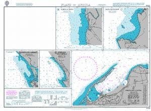
- UKHO BA Chart 3448: Plans in Angola


منتج #:
148541005
UKHO BA Chart 3448: Plans in Angola
منتج #:
148541005
ILS 426
تفاصيل السعر
باستثناء رسوم الشحن والجمارك ( سيتم احتساب رسوم الشحن والجمارك عند إتمام الشراء )
*سيتم استيراد جميع العناصر من أمريكا
0 ratings
اكتب رأيك
متوفر فى المخزون
 مستورد من متجر USA
اطلب الآن واحصل عليه حول الخميس, سبتمبر 24
معاملة آمنة
تعمل يوباي جاهدة لحماية أمنك وخصوصيتك. يضمن نظام أمان الدفع المتقدم لدينا السرية من خلال تشفير معلوماتك أثناء النقل باستخدام بروتوكولات AES (معايير التشفير المتقدمة) وSSL (طبقة المنافذ الآمنة). تفاصيل الدفع الخاصة بك آمنة بنسبة %100 لأننا لا نشارك تفاصيل الدفع الخاصة بك مع بائعين تابعين لجهات خارجية
أفضل شركائنا اللوجستيين


Admiralty standard nautical charts comply with Safety of Life at Sea (SOLAS) regulations, making them essential for safe navigation.

شحن
سريع

استرجاع
مجاني*

تغليف آمن

منتجات أصلية %100

الامتثال لمعيار PCI DSS

حاصل على شهادة ISO 27001



Note: Step Down Voltage Transformer required for using electronics products of أمريكا store (110-120). Recommended power converters اشتري الآن.


مايفيد
Comprehensive Coverage
UKHO BA Chart 3448 provides detailed plans of Angola's coastal and navigational areas, ensuring mariners have access to accurate and up-to-date information for safe navigation.
User-Friendly Format
Designed for ease of use, this chart offers clear visuals and straightforward layout, making it accessible for both novice and experienced navigators in uncertain waters.
Regulatory Compliance
The chart meets international maritime standards, ensuring users adhere to necessary regulations while navigating, enhancing safety and efficiency during maritime operations in Angola.
تفاصيل المنتج
| Item Weight | 0.5 lbs (230 grams) |
من يجب أن يشتري؟

-
Marine Navigation
Ideal for sailors and navigators needing accurate charts for safe passage in Angolan waters, enhancing navigation reliability.
-
Commercial Fishing
Beneficial for commercial fishermen looking to locate productive fishing zones in the Angolan region, optimizing their harvest.
-
Shipping Industry
Essential for shipping companies operating in Angola, providing crucial route planning information to avoid hazards and ensure safety.

-
Land-Based Travel
Ineffective for individuals relying on charts for land navigation; it's solely focused on marine areas in Angola.
وصف المنتج
UKHO BA Chart 3448: Plans in Angola
هل لديك أي استفسار؟ تحدث معنا
أسئلة العملاء & الإجابات
-
سؤال:
What is the BA Chart 3448 used for?
إجابه: BA Chart 3448 is primarily designed for maritime navigation, enabling sailors to navigate specific regions safely. It provides crucial topographical details that assist in understanding water depth, coastal features, and potential hazards. This type of chart is essential for both professional mariners and enthusiasts, as it enhances situational awareness while at sea. -
سؤال:
What are the key features of BA Chart 3448?
إجابه: The key features of BA Chart 3448 include accurate representation of coastal lines, depth soundings, navigational aids like buoys and lighthouses, and designated shipping routes. These aspects are vital for effective navigation. With detailed cartographic data, sailors can plan their journeys with improved confidence, ensuring they avoid danger zones and navigate efficiently. -
سؤال:
How often is BA Chart 3448 updated?
إجابه: BA Charts like Chart 3448 are regularly updated to reflect changes in maritime geography and regulations. Updates are based on new surveys and data collected locally, ensuring accuracy and reliability. Regular checks of the latest edition are recommended, especially before setting sail, to account for any alterations that may affect navigational safety. -
سؤال:
Is BA Chart 3448 suitable for recreational boaters?
إجابه: Yes, BA Chart 3448 is suitable for recreational boaters and provides vital information for anyone engaging in maritime activities. Whether navigating along the coast or exploring inland waters, this chart helps recreational maritime enthusiasts make informed decisions. Additionally, having the correct chart can enhance enjoyment by ensuring a safer exploration of new areas. -
سؤال:
Can BA Chart 3448 be used for fishing trips?
إجابه: BA Chart 3448 is very useful for fishing trips as it indicates areas with varying depths and identifies spots that are ideal for different types of fish. Understanding the underwater landscape helps anglers choose the best locations to cast their lines. Utilizing this chart can significantly increase the likelihood of a successful fishing trip. -
سؤال:
What scale is BA Chart 3448 printed in?
إجابه: BA Chart 3448 is printed at a scale that offers detailed insights suitable for navigation while still providing a broader perspective of the area. This scale allows for easier identification of landmarks and navigational markers. When planning a route, selecting a chart with an appropriate scale is crucial for both tracking and adjusting positions accurately. -
سؤال:
Who creates BA Chart 3448?
إجابه: BA Chart 3448 is created by the United Kingdom Hydrographic Office (UKHO), which specializes in producing high-quality navigational charts. Their expertise ensures that the charts meet international standards for safety and navigation precision. Relying on a reputable source enhances trust in the accuracy and utility of the chart for maritime navigation. -
سؤال:
What is the size of BA Chart 3448?
إجابه: The size of BA Chart 3448 is designed to be practical for onboard use, fitting general navigational kits or chart tables. Many mariners appreciate standard sizes that facilitate easy handling during voyages. The manageable dimensions ensure that it can be spread out on a boat for reference without taking up excessive space. -
سؤال:
Where can I buy BA Chart 3448: Plans in Palestine?
إجابه: You can buy BA Chart 3448: Plans in Palestine from Ubuy. They offer a great selection of navigational charts, including the BA Chart 3448, ensuring that mariners in Palestine can easily access essential navigation tools. Ubuy is a trusted retailer that provides convenience and variety right at your fingertips. -
سؤال:
Is BA Chart 3448 available in digital formats?
إجابه: Yes, BA Chart 3448 is available in digital formats, allowing for easy integration with electronic navigation systems. Digital charts provide mariners with interactive elements, such as zoom functions and real-time updates. Utilizing a digital format can enhance navigation and safety, especially when paired with compatible chartplotters or marine apps.
UKHO Charts & Maps Editorial Review
لم يتم العثور على مراجعات تحريرية
مراجعات العملاء وتقييماتهم
1 تقييمات العملاء
-
5 نجمة
100%
-
4 نجمة
0%
-
3 نجمة
0%
-
2 نجمة
0%
-
1 نجمة
0%
أضف تقييم لهذا المنتج
شارك أفكارك مع عملاء آخرين
منصة موثوقة وثقة كاملة للمشتري

JG
Jazz
مشتري موثّق
“Easy to use and always helpful and sorts any issues I've had past and present”
1 September 2026 · عبر Trustpilot
EK
Emmanuel
مشتري موثّق
“I always receive support when I engage customer service. Overall my experience with UBUY has been top notch. Keep up the good work.”
31 August 2026 · عبر Trustpilot
F
fnd
مشتري موثّق
“The delivery was fast and the product came undamaged and authentic.”
29 August 2026 · عبر Trustpilot
LC
Leana
مشتري موثّق
“Ubuy is extremely efficient and to order online is an easy process. The verity of products to buy is really unlimited! My order was urgent and I got it on time. The products are great! Thank you Ubuy!”
25 August 2026 · عبر Trustpilot
HL
Hengo
مشتري موثّق
“Fast, convenient and cheap. Great store!”
27 August 2026 · عبر Trustpilot
الخروج الآمن
شحن عالمي
إسترجاع سهل
منتجات أصلية
تاريخ سعر المنتج
معلومات مهمة
- القيود: بالنسبة للمنتجات التي يتم شحنها دولياً، يُرجى ملاحظة أن أي ضمان من الشركة المصنعة قد لا يكون صالحاً؛ قد لا تتوفر خيارات خدمة الشركة المصنعة؛ قد لا تكون أدلة المنتج والتعليمات وتحذيرات السلامة مكتوبة بلغة بلد المقصد؛ قد لا يتم تصميم المنتجات (والمواد المصاحبة لها) وفقاً لمعايير بلد الوجهة والمواصفات ومتطلبات الملصقات؛ وقد لا تتوافق المنتجات مع الجهد الكهربي المستخدم في بلد الوجهة والمعايير الكهربائية الأخرى (تتطلب استخدام محوّل كهربي أو جهاز تحويل إذا كان ذلك مناسباً). المستلم مسؤول عن ضمان إمكانية استيراد المنتج بشكل قانوني إلى بلد الوجهة. عند الطلب من يوباي أو الشركات التابعة لها، يكون المستلم هو المستورد المسجل ويجب أن يلتزم بجميع القوانين واللوائح الخاصة ببلد الوجهة.
- ليست كل المنتجات المدرجة على يوباي معروضة للبيع، لأن يوباي هو محرك بحث عالمي. المنتجات تخضع للوائح التصدير / التجارة.
ILS 426
اطلب الآن واحصل عليه حول الخميس, سبتمبر 24
هذا المنتج غير ممنوع في بلدي. (الرجاء الضغط على الرابط أعلاه إذا لم يكن هذا المنتج ممنوعاً في بلدك ، لذلك سيقوم فريقنا بمراجعته والسماح به.)
كمية:
معاملة آمنة
نوفر لك مدفوعات مشفّرة، وحماية متكاملة للمشتري، مع الالتزام بمعايير PCI DSS وشهادة ISO 27001:2022 لضمان أعلى مستويات الأمان في كل عملية شراء.
أفضل شركائنا اللوجستيين
أسرع توصيل عبر الحدود
المميزات والفوائد
- Complies with SOLAS regulations for safe navigation.
- Ideal for professional, commercial, and recreational use.
- Includes a range of scales for various navigation needs.
- Supplemented by routing guides for busy waterways.
- Corrected to the latest NTM at point of sale.
- Approved by the U.S. Coast Guard and produced by leading experts.
ضمان Ubuy
تسوّق بثقة مع منتجات أصلية %100، ومدفوعات آمنة متوافقة مع معيار PCI DSS، وحماية بيانات معتمدة وفق ISO 27001، وشحن دولي سريع، وإرجاع مجاني*، وتغليف آمن لكل طلب.